We are pleased to announce the launch of the Alpine Convention Atlas, the new tool for exploring and visualising data from across the Alps!
Research and data collection have been a focus of the Alpine Convention since its early days. In order to collect, manage and disseminate transnational information on topics of interest, the Contracting Parties established the System of Observation and Information on the Alps (SOIA).
Through sharing results and data, the SOIA aims to improve the communication of the research and observation activities carried out at Alpine level. In addition, the SOIA seeks to foster integration and cooperation among Alpine countries in the research sector.
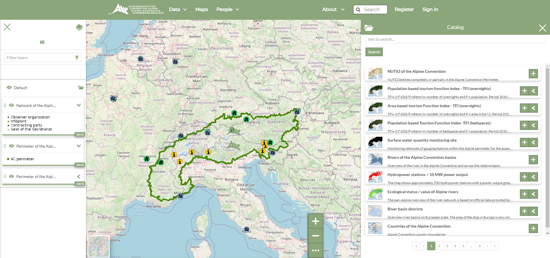
The new Atlas forms one of the core activities within the SOIA. It enables the management, visualisation, and dissemination of Alpine-wide data collected in the scope of the Alpine Convention's activities, covering topics that range from demography to climate, and from air to water.
Although the Atlas focuses primarily on geospatial information (layers and maps), it also includes documents, datasets and other features to help you discover more about the Alps.
Atlas is an open-source technology and free to use. Moreover, content can be tailored based on your user settings, and you can create your own thematic maps using the different layers. This allows you to personalise your journey through the fascinating world of data from the Alpine space.
Begin your Atlas journey here!