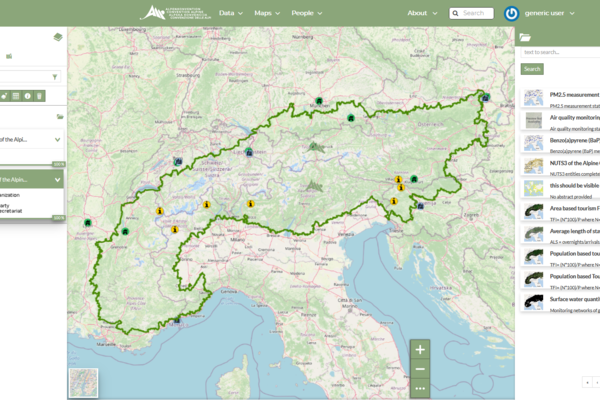
Alpine Convention Atlas
One of the most relevant activities within the SOIA is the Alpine Convention Atlas, which enables the management, visualisation and dissemination of Alpine-wide data collected in the scope of the Alpine Convention's activities.
The Atlas focuses primarily on geospatial information (layers and maps) but it also includes documents, datasets and much more. Browse the Atlas by category to find out more about the Alps and the Alpine Convention – you can even create and upload your own maps!