Have you already seen our new Atlas tool that allows you to explore, create and share maps of the Alps? If not then our new Map of the Month will give you an insight into what is on offer!
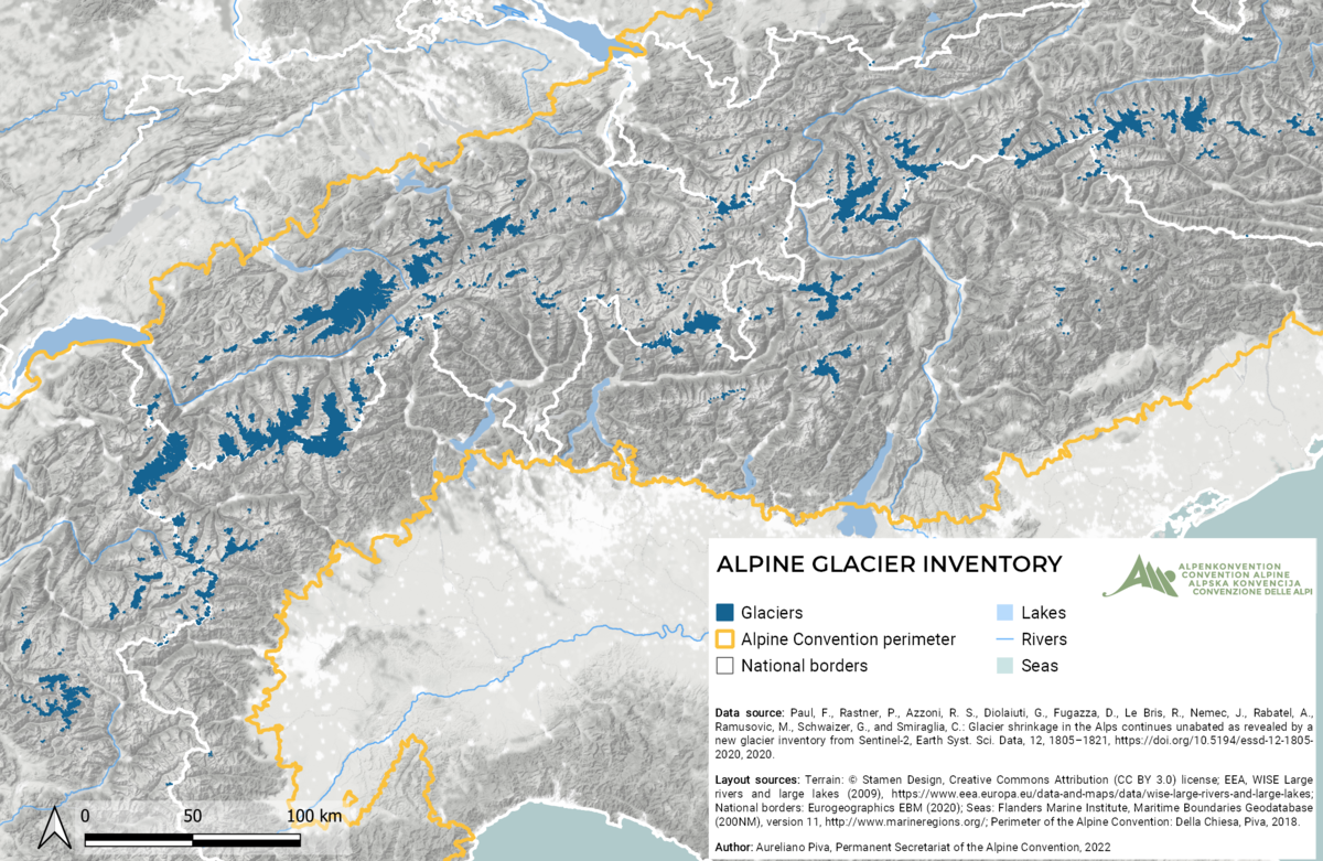
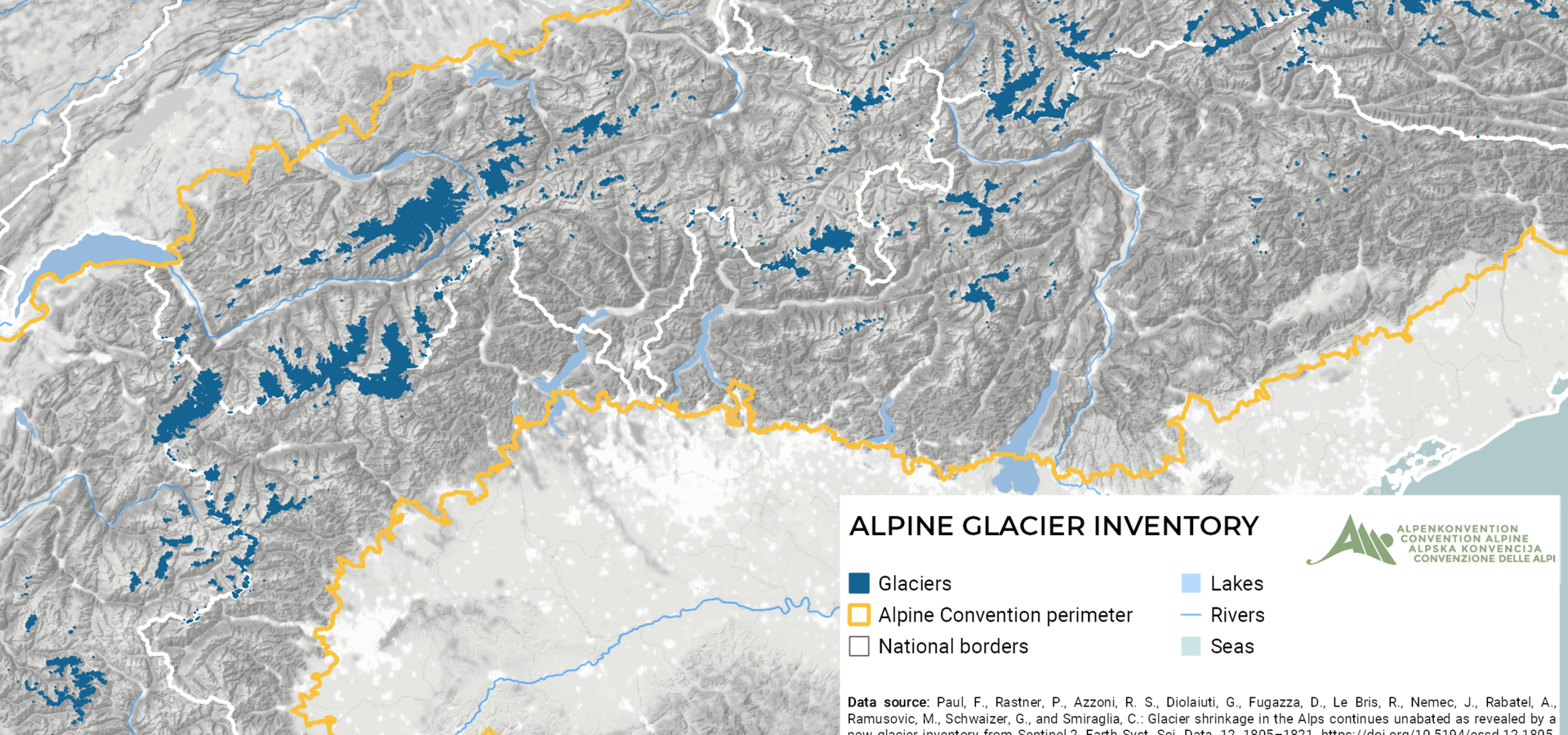
Our first map is about glacier coverage in the Alps based on a recent article. It shows that the area covered by glaciers in the Alps in 2015 was about 300 km2 less than in 2003 – a loss of at least 14% over about 12 years. This corresponds to more than 40.000 football pitches of Alpine glacier that have disappeared!
Climate change is having a significant impact on the Alps, with temperatures in the region increasing almost twice as quickly as in the rest of the northern hemisphere. The temperature rise of almost 2°C since the late 19th century is already widely affecting the Alpine environment, including the iconic Alpine glaciers. Read on to find out what the Alpine Convention is doing to fight climate change.
The Atlas is a great tool to learn more about the Alps and the Alpine Convention. It allows you to browse by category to explore layers, thematic maps, and documents. Have you not found what you were looking for? Then create or upload your own maps to the Atlas and share your knowledge with the rest of the community.
We will be regularly posting new maps from the Atlas, so make sure to follow our social media channels (Facebook and Twitter). We hope you will enjoy learning about the Alpine Convention Atlas, and that you will be inspired to begin your own GIS journey!